Mapping
A research was first conducted to understand methods to visually map senses like smell and touch. This thesis involves understanding the ways an animal perceives space, and since humans are visually dominant species, visual connotations and graphics are methods aptly conceived for developing a stronger argument.
Sensorial Mapping Research

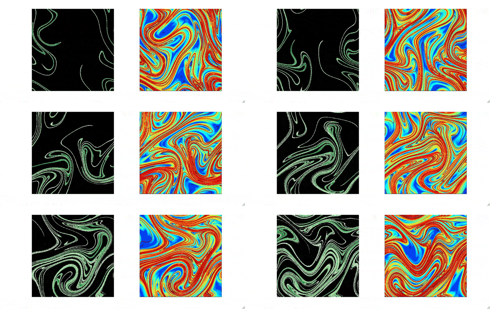
University of Colorado Boulder - fluid mechanics of fragrances
-
Fluid mechanics of 'smell'
-
Lasers hit molecules of sulphuric gas emitted from an exhaust
-
To visualise drifting of odours in space; to in turn understand how humans and animals navigate through surroundings through smells.
-
To define an 'innate strategy' for olfactory navigation.

University of Colorado Boulder - fluid mechanics of fragrances
Computer generated models of odours:
-
Green: light = lower concentration
dark = higher concentration -
Coloured: Amount of stretching
blue = low amounts
Red = higher amounts of drifting

Kate McLean, Sensory Maps - Smellmap Amsterdam (spring 2013)
-
Kate Mclean is a psychologist placing special emphasis on identity construction
-
Visual map of Amsterdam is developed as series on contours
-
These contours mark smells the narrator experienced in the city (bakery, sewer, hospital, laundry, books)
-
The city, without the base satellite image of the space, becomes a landscape of smells drifting with the wind.
-
The mapping strategy becomes an artistic depiction of a narrator's olfactory experience

Manuel Zarzo - Valencia Polytechnic University - Olfactory Matrix
-
A statistical distribution of variables as 'descriptors' in a matrix
-
Plotting is to reflect similarities and dissimilarities as parameters
-
Nodes are marked (descriptors); closer ones are positively correlated
-
The ones which are similar variables but have different sources are connected to create a polygon
-
The matrix is used to identify/visualise, diagrammatically, a smell and its characteristics.
A 3D model was conceived to recreate the activities on site and develop a digital space. The same model is used to generate diagrams as explained further, and to conduct 2 strategies (thermal comfort & notional mapping)
Notional bubbles/nodes are marked in the 3D environment which adds a layer of the ways in which activities and spaces are perceived by the animal

The notion layer is isolated to create the landscape of perceptions. The isolation of
the notion layer helps to percieve the site not in its physical form, but rather depicts
the plethora of notions it holds. These notions are factors which determine the
actions, movements and fight or flight decisions of the street animal.
The entire site is considered in a top view.
Notions are marked across the site.
Real-time movement of notions is programmed according to the activities on site.
Certain moments are extracted to articulate actions of the animal (or human) at that moment.
Dark Blue: Specific Activities
Light Blue: Children Playing
Yellow: Familiarity Notion
Red: Spaces of Fear
Green: Spaces to procure food (feeder/organic garbage)
Deriving strategies from the theoretical base, a street animal will prefer to find a thermally comfortable space rather than make one by digging or moving items.
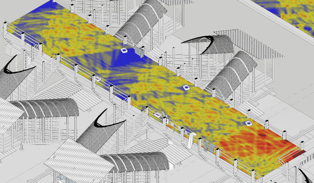
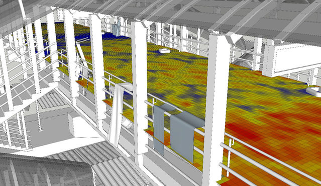
The 2nd step of analysis is one of thermal comfort to find the spots on site which are cool during warmer days and likewise comparatively warmer during cold days.
This will help track the movement and resting spaces of the street animal not only daily, but intra annually. The analysis was conducted for a period of 50 days (all saturdays of the year) for a time period of 5AM to 11PM for each day. The analytical diagram that is generated is the average of the entire year. Over a period of time, once the street animal considers an area its territory, throughout the year it will not be displaced by a great amount with respect to thermal comfort, but will find the most optimum space in that specific area, hence the liberty was taken to conduct only 1 analysis for the entire year which is most accurate.
The 3 mapping methods are followed to account for not only sociological aspects, but also physical parameters which decide the reasoning behind a street animal occupying a certain space. Through the following exercises, each case study is scrutinised to develop a better understanding of the way the site is perceived by the street animal, and the subsequent relationship the street animal(s) has with humans and other species.
The 3D model with all the paraphernalia on site helps to recreate all scenes on site, extrapolating crucial data required for the subsequent mapping methods required to determine and mimic the thought process of the street animal.
The nodal mapping and notion landscape mapping exercise allows to see the site through the lens of sociological activities which determine the ways of the street animal. The physicality of the site is overlooked and only the sociological phenomenon present on site are considered.
The moment articulation exercise involves the study of any one moment during the study of the daily routine’s notion landscape mapping exercise. Here, in any one moment, the notional landscape is scrutinised to speculate the next move of the animal, allowing for a more
informed understanding of a street animal’s mentality.
The thermal comfort mapping exercise is informed from the theoretical understanding that a street animal will choose to find a comfortable spot rather than dig or make one. This exercise does not consider the sociological factors but only the comfort levels based on day light, shading, CFD (wind speed cooling) and such factors.
Mapping Strategy
6 different cases were identified within the city to develop an understanding of the ephemeral social arrangement that exists amongst species.
These cases involve varying types of interactions amongst species, leading to varying ways the street animals understand a human-centric urban landscape, and negotiate a survival behaviour to accommodate themselves in the urban.
The case studies:
1. P. D'Mello Street (Raja aka Chappal Chor): Chappal Chor in Hindi stands for ‘Footwear Thief’, an aptly named dog by the street dwellers of the vicinity. The pup was born a couple of kilometers away in another territory, and had meandered and settled on P D’Mello Street, where the street dwellers had taken him in. He has a habit of a delinquent, stealing footwear of the individuals which are placed outisde their homes, running away with said footwear, chewing them and very often breaking them, and bringing them back.
2. Mahalaxmi (Lali): Lali is a dog who was brought to our Welfare of Stray Dogs kennel for sterilisation. After post-op recovery, she was released back to her original territory, some 5-7 kilometers away. She figured her way back to the kennel over the next couple of days, and now resides right outside the kennel gates. She has found a friend in some of the dogs and cats in the vicinity. Lali spends her mornings in the kennel itself, keeping an eye on the cats and making sure everyone gets enough to eat, while in the evenings she goes down the street to a dumping space to devour food along with the other dogs from the neighbouring territories.
3. Metro Theatre: A street dwelling family has accommodated 3 street animals from the vicinity, including a female whose pups reside on a ground across the street. Every morning, the lady rides to the ground, with the female riding along on the scooter, and they go visit the pups.
4. Railway Stations: 3 moments were studied, one on the railway station platform, one on the footbridge along with the street dwellers who live on the bridge, and one outside the station, a cacophonous space bustling with rushing people and stalls selling flowers, savory, fruits, phone covers and such.
5. Marina Bay Construction Site: The construction site in Worli was previously a slum, which housed around 15 dogs in the vicinity. They were cared for by the residents of the slum and assumed the slum as their territory. Once the slum was broken down, they seeked shelter in various corners of the site, petrified of human movement. The building was recently completed and occupied, because of which the dogs, now 26 in number, are on the street.
6. Bandra Kurla Complex: A concretised area housing commercial buildings, the complex seems to be imagined through Western connotations o fsuccess. With barely any spaces for a street dweller (the Complex itself was validated by breaking down existing slums) to find a niche for themself, the area is a highly tricky space for street animals to reside.


